 -Image Processing for better Yield-Awareness-
Laketec Remote Sensing Image Processing for Precision Agriculture provides informations about crops and vegetation status to give you better yield estimations and to get a faster return on investment.
-How it works-
Precision agriculture is now changing the way farmers and businesses view the land from which they reap their profits.
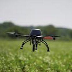
GPS technology and huge kinds of sources derived from various satellite mission and innovative APR imagery provides accuracies in inches or less. Image processing Normalized Difference Vegetation Index (NDVI), as an effective crop monitoring tool, is extensively used in crop yield estimation and water deficit.
-Benefits-
Calculate the amount of fertilizer for any field, detect crop infestation, as well as apply spring fertilizers and pesticides. Your farm equipment for planting, harvesting, spraying pesticides and herbicides, or applying fertilizers accurately, yield can be improved significantly.
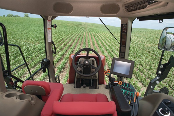
“we’ve got sensors on the combine, GPS data from satellites, smartphone on self-driving tractors, apps for irrigation on iPhones"
| SITE SPECIFIC MANAGEMENT |
|---|
| NUTRIENT |
| FERTILIZER |
| IRRIGATION |
| YIELD PREPARATION |
SITE SPECIFIC
Site-specific farming allows farmers to identify, analyze, and manage the spatial and temporal variability of soil and plants for optimum profitability, sustainability, and protection of the environment.
SUSTAINABLE
Determining the right amount of fertilizer to apply with the right timing has considerable impact on yield, protein content, fertilization cost and the environment. Precision farming tools allow farmers to adjust fertilization to the exact needs of plants at every spot on the field.
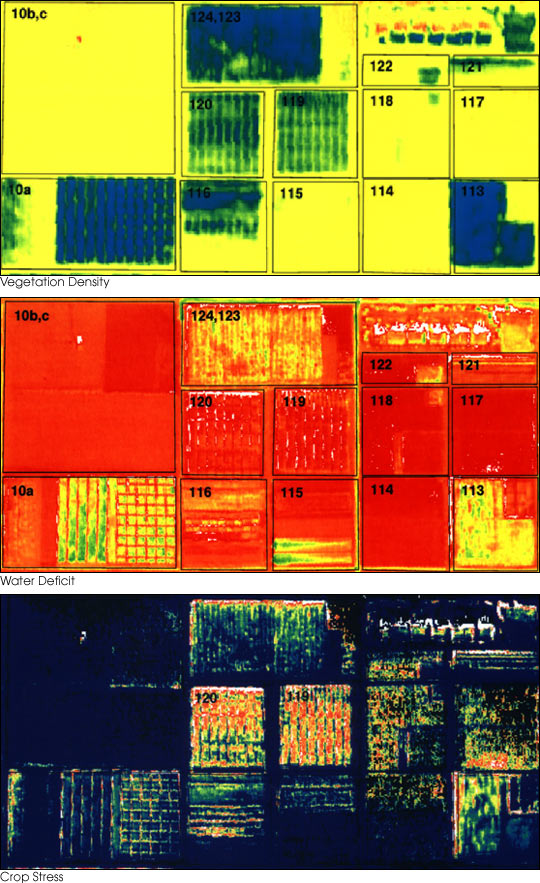
These three false-color images demonstrate some of the applications of remote sensing in precision farming. The goal of precision farming is to improve farmers’ profits and harvest yields while reducing the negative impacts of farming on the environment that come from over-application of chemicals. The images were acquired by the Daedalus sensor aboard a NASA aircraft flying over the Maricopa Agricultural Center in Arizona. The top image (vegetation density) shows the color variations determined by crop density (also referred to as “Normalized Difference Vegetation Index”, or NDVI), where dark blues and greens indicate lush vegetation and reds show areas of bare soil. The middle image (water deficit) is a map of water deficit, derived from the Daedalus’ reflectance and temperature measurements. Greens and blues indicate wet soil and reds are dry soil. The bottom image (crop stress) shows where crops are under serious stress, as is particularly the case in Fields 120 and 119 (indicated by red and yellow pixels). These fields were due to be irrigated the following day.
GOOD PRACTICES
Good Agricultural Practices ["Executive Summary," Report of the Expert Consultation on a Good Agricultural Practices (GAP) Approach, Rome, Italy, 10-12 November 2003. (FAO Agriculture Department Report, Food and Agriculture Organization (FAO) of the United Nations). Available at FAO Website